
/
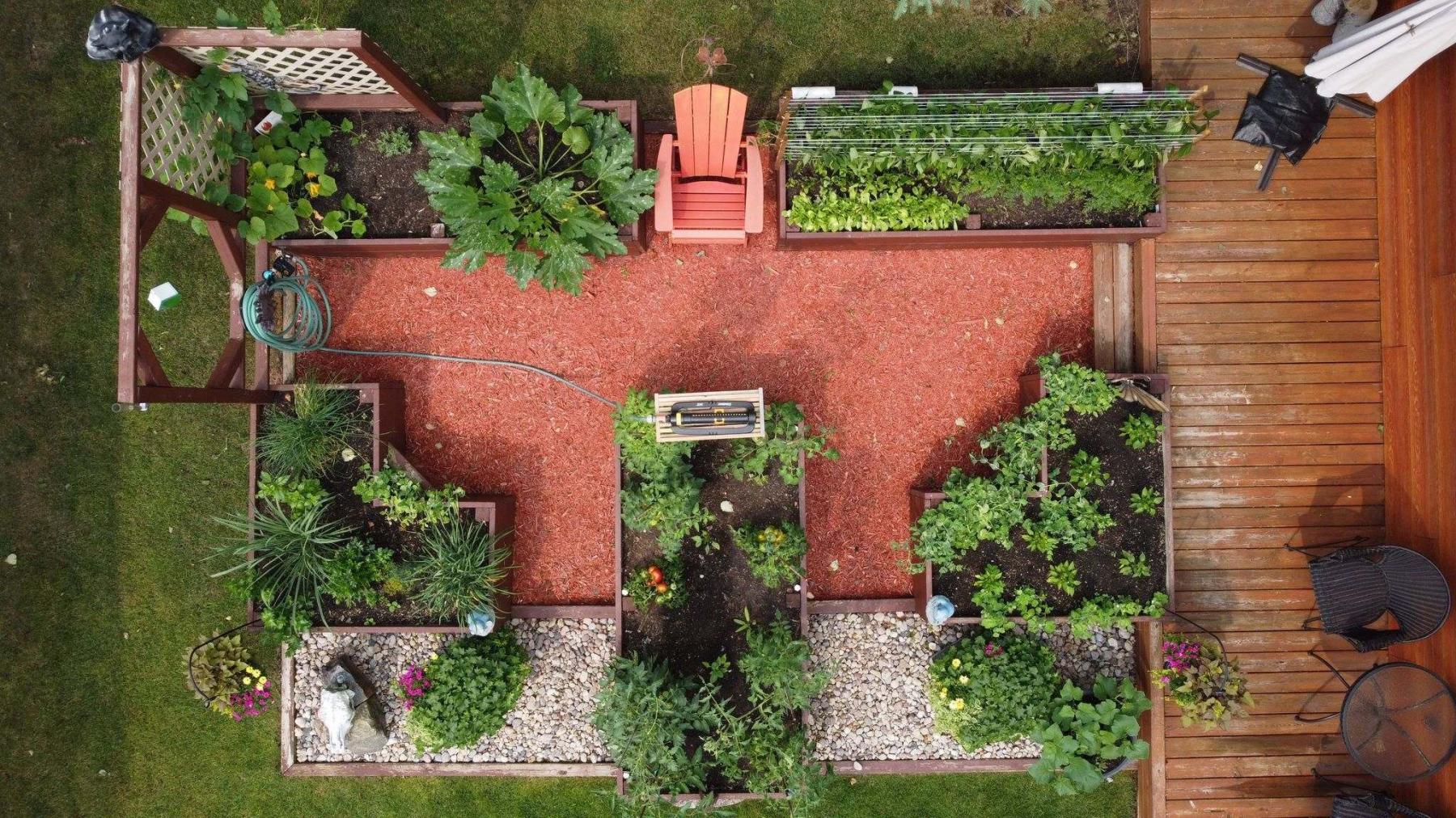
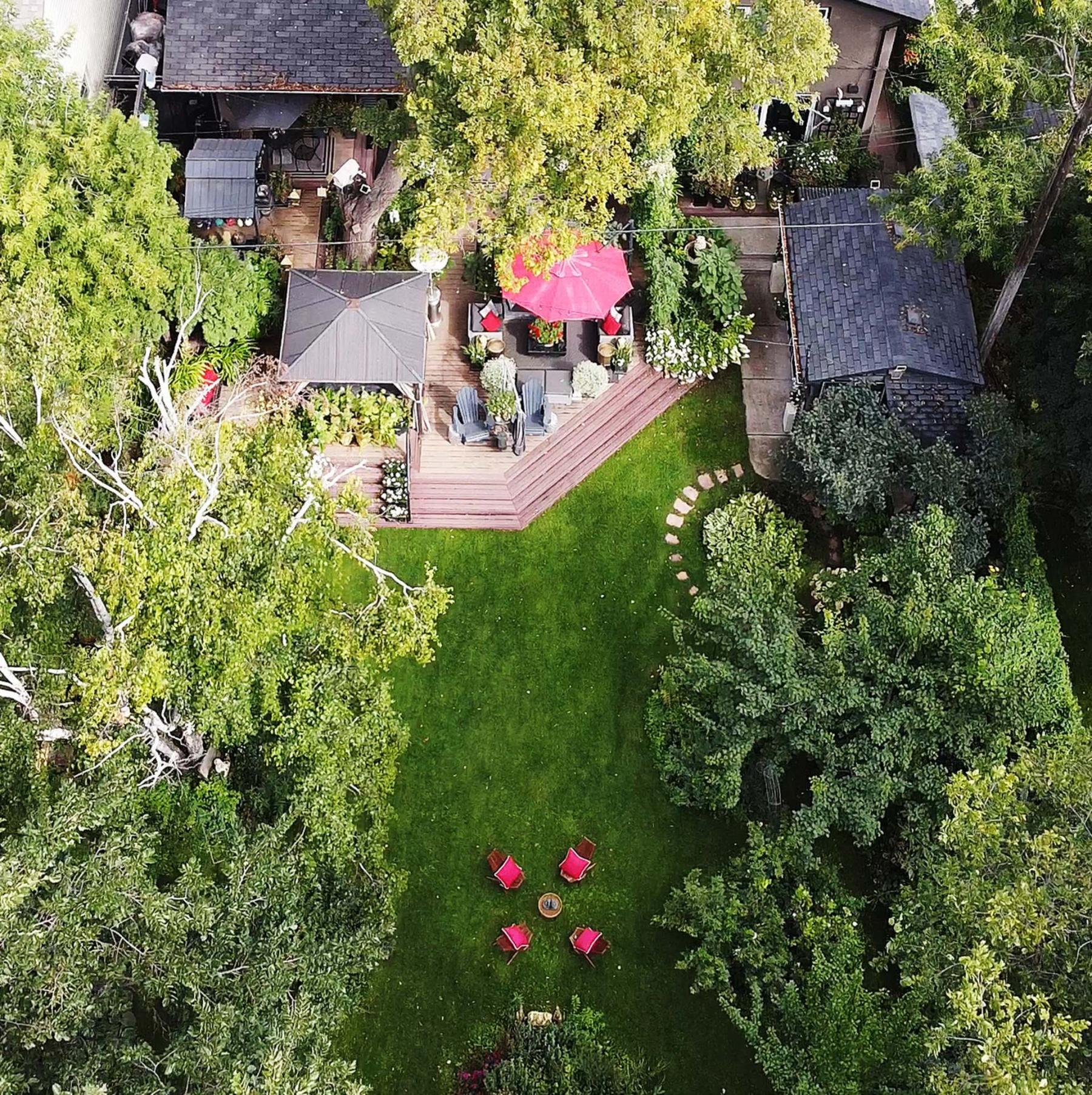
An aerial view of Gosia Barrette’s garden shows gaps she now plans to fill with more perennials.

/
Richard Denesiuk flies a micro-drone that weighs less than 250 grams.
/
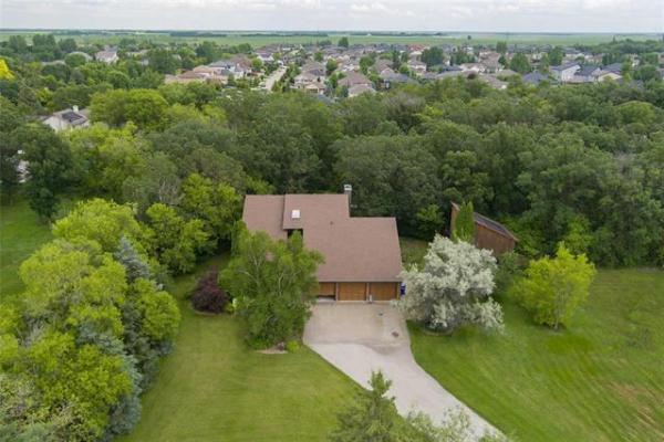
A bird’s-eye view of Tim Evans’ riverfront property.
/
An aerial drone video that flies low and slow over a stream is butterfly-like.
Shifting your perspective assists in bringing you to new creative solutions. Could the aerial images captured by a drone fly-over assist you in planning your landscape or making changes or additions to your garden?
Richard Denesiuk is a skilled photographer who has taken countless photos with many types of cameras including smartphones and tablets. The former executive director of Creative Retirement Manitoba, Denesiuk was also the editor of the Prairie Garden for nine years, an annual publication that features numerous photos of gardens and landscapes from across the Prairies. Well versed in image editing software, Denesiuk has embraced a new challenge: how to fly a drone.
This year Denesiuk logged 13.1 hours and 36.6 kilometres in 126 flights. To develop his skill at flying, he visited several different gardens this past summer. It was a learning experience for both Denesiuk and a unique opportunity for the garden owners.
Denesiuk flies a DJI Mini 2 drone which delivers up to 30 minutes flying time. Compact and ultralight, it weighs just 249 grams. Micro-drones are drones weighing less than 250 grams. According to Transport Canada, pilots of micro-drones are not required to register their drone or obtain a drone pilot certificate. In Canada, drone flights are regulated by Nav Canada which oversees all air traffic in Canada. Drone pilots must adhere to proper regulations for the weight of their drone, maintain distance from bystanders and follow airspace rules.
The same key rules that apply to lighting in more traditional photography also apply to drone image capture, says Denesiuk. For example, what time of day are the light conditions in your landscape ideal? "On a sunny day, shade thrown by large trees can cause problems as cameras cannot record brightly lit areas and shady areas in the same frame," he says. "If shadows are typically an issue, then an overcast day provides even lighting." To capture high-quality images, Denesiuk recommends the golden hour — the last hour before sunset and the first hour after sunrise.
Wind is always a factor, says Denesiuk. "Wind can sometimes take a drone off course, and generally, the wind speed increases with height." The DJI Mini 2 can withstand winds of up to 37.8 km/h. "And that’s the difference between a toy drone and a real drone," says Denesiuk, "because GPS satellites are not controlling toy drones." Crashing a drone can be an expensive mistake. For data on unmanned aerial vehicle forecasts including current wind conditions and visibility, he recommends the website uavforecast.com.
This summer, Denesiuk visited the garden of Gosia Barrette who is a member of East Kildonan Garden Club where Denesiuk volunteers as a judge for EKGC’s annual photo contest. Barrette lives in a bungalow and her deck is at ground level. "It’s a very flat perspective," she says, "without any opportunity to see it from a bird’s eye view. I was so interested in having a drone video because I wanted to have a full view of the entire space to be able to play around with where I thought some improvements or additions could be made."
Barrette’s landscape is defined by clean lines, raised beds, lots of perennials and a neatly clipped Alpine Currant hedge. "The still shots were very helpful to see where some of the gaps were," she says. "I will study the video and still images over the winter and my plan for next year is to really devote time to filling in the empty spaces." But Barrette also says her plan is to focus on planting multiples of, say, five different plant varieties as opposed to numerous individual plant varieties.
The riverfront property where Tim Evans lives is classified as a restricted zone for flying drones because of its close proximity to Winnipeg James Armstrong Richardson International Airport. Drone pilots must log into DJI and request authorization to fly in that zone. Without authorization, software prevents the drone from even taking off, says Denesiuk. "Once registered, DJI knows who I am, the type of drone I am flying, where I am flying, how high, etc."
Denesiuk uses a Samsung Galaxy tablet with an eight-inch screen which he connects with a cable to the controller that flies the drone. When the drone was no longer visible as it flew above Evans heavily treed property, the tablet showed the images he was capturing. Evans says he was very impressed by the aerial views of his landscape. After studying the video and still photos, Evans plans to add some larger-specimen shrubs such as Euonymus alatus Burning Bush which has brilliant red fall foliage as well as more purple foliage, a nice contrast to the 100-plus hydrangeas he grows in his garden.
The drone images also provided Evans with a bird’s-eye view of his mature tree canopy which is beginning to show signs of drought stress, particularly in the crowns of his birch trees and upper branches of oak trees.
Robin and Annette Cadzow live year-round at Booster Lake located in Nopiming Provincial Park, about a two-hour drive from Winnipeg. Denesiuk captured aerial images of their raised-bed vegetable garden as well as the bush areas of their property. They were thrilled to have aerial images of their property which was once a winner of the Manitoba Good Roads Association Burgess Shield Award. After viewing the images, both he and Annette decided they would add garden boxes to their deck next year and grow Concord grapes because that area receives so much direct sunlight.
"We sat on a forest fire alert all summer long and had our bug-out bag ready to roll," says Robin. The drone images provided an opportunity to see the deadfall in the bush, says Robin, who studied the images closely to see if there was anything that might be a fire hazard.
When Denesiuk flew his drone over my front courtyard, the aerial view helped me to realize I needed to add more colour. Within a week, out came my Double Fernleaf peony which has only a brief bloom period and in went a floriferous Moonrock hydrangea.
It is common now for realtors to use drones and powerful 360 cameras. Drones are also used by landscape designers. Keith Lemkey, Lemkey Landscape Design Ltd., utilizes drones for before and after photos. A drone provides a better perspective of a landscape space, says Lemkey, and allows the designer instant recall of the layout. "We can better see adjoining sites, neighbouring trees, and neighbours’ window views that need privatizing." The visual aspect a drone provides, says Russ Penny of Netley Creek Landscaping, is also useful in site planning for a landscape that is heavily treed, which can make it challenging to take an exact measurement.
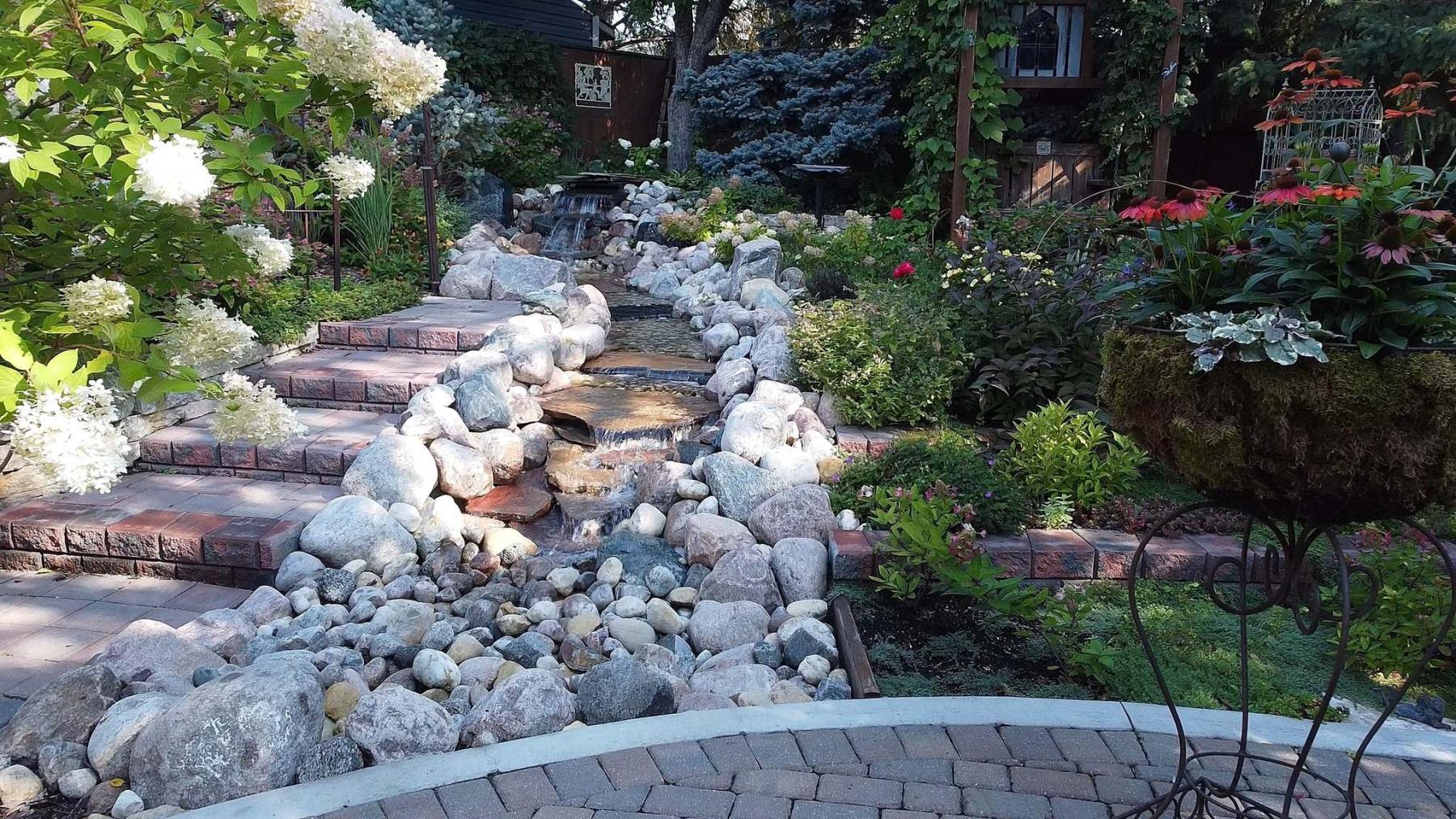
Denesiuk looks forward to expanding his awareness and developing his flying skills. "Low, slow shots through an arbour or along a pathway or stream seem kind of dreamlike or butterfly-like — that’s what I’m really enjoying," he says. Videos that are one to two minutes long and consist of four or five images are immersive and can make you feel like you are there.
colleenizacharias@gmail.com